Book a Shoot
Book a Shoot
(719) 890-9016 garret@apexcontentcompany.com
Construction • Contractor Media • APEX Intelligence • Now Launching

Construction & contractor media.

From as-built photography and aerial site surveys to APEX Intelligence 3D terrain mapping — bringing the same standard we built in real estate to the construction industry across Southern Colorado.

Services Launching

What we're building.

The same gear, the same FAA-certified drone capability, and the same process that built our reputation in real estate — now for construction.

🏠

As-Built Photography

Professional documentation of completed construction for permit records, client handoff, portfolio building, and insurance.

📷

Progress Documentation

Scheduled site visits documenting construction from groundbreak to completion — ground-level and aerial combined.

Aerial Site Surveys

DJI 6K aerial photography and video of construction sites, excavation, grading, and infrastructure.

🎥

Contractor Brand Videos

Cinematic showcase videos of your completed work — before-and-after, time-lapse, project highlights that win bids.

📈

Contractor Marketing

Digital marketing, Google Business optimization, social media content, and local SEO for contractors in Southern Colorado.

🔨

Portfolio Builds

End-to-end documentation of a contractor's complete project portfolio — photographed, edited, and ready for bids and social.

Site Intelligence & 3D Mapping

APEX Intelligence.

Our professional mapping platform — available for real estate and construction. Think of it as a 3D model for land. Every acre. Every pond. Every fence line. Documented from above.

Real Estate
Property Boundary Lines & Mapping

Live parcel boundary data overlaid directly on aerial video footage. Out-of-state buyers in Texas and California can virtually explore a Colorado ranch before they ever book a flight. Every acre, every pond, every fence line — documented from above and delivered in a format that closes deals from 1,000 miles away.

  • Parcel data overlaid on footage, frame-accurate
  • Acreage displayed on screen as drone flies property
  • Water features and ponds labeled by name
  • MLS, Instagram, YouTube — all formats delivered
Construction
Site Surveys & Progress Mapping

Pre-construction site surveys, excavation and grading progress, as-built aerial documentation — GPS-referenced and precise. The data your team needs at every stage, plus marketing material that proves the scope of your work to the next client.

  • Pre-construction site condition baseline
  • Progress mapping at scheduled milestones
  • Final as-built aerial with GPS coordinates
  • BIM-ready 3D model outputs available
Orthomosaic Aerial MapGeometrically corrected overhead map. Current to the day of the flight. Sharp enough to read every fence line.
3D Terrain ModelComplete 3D model of the land. Out-of-state buyers navigate the property virtually before booking a flight.
NDVI AnalysisVegetation health mapping. Reveals productive pasture, water reach, and land condition.
Elevation & TerrainDigital elevation models showing drainage, slope, and topographic features.
APEX Intelligence four-panel site analysis
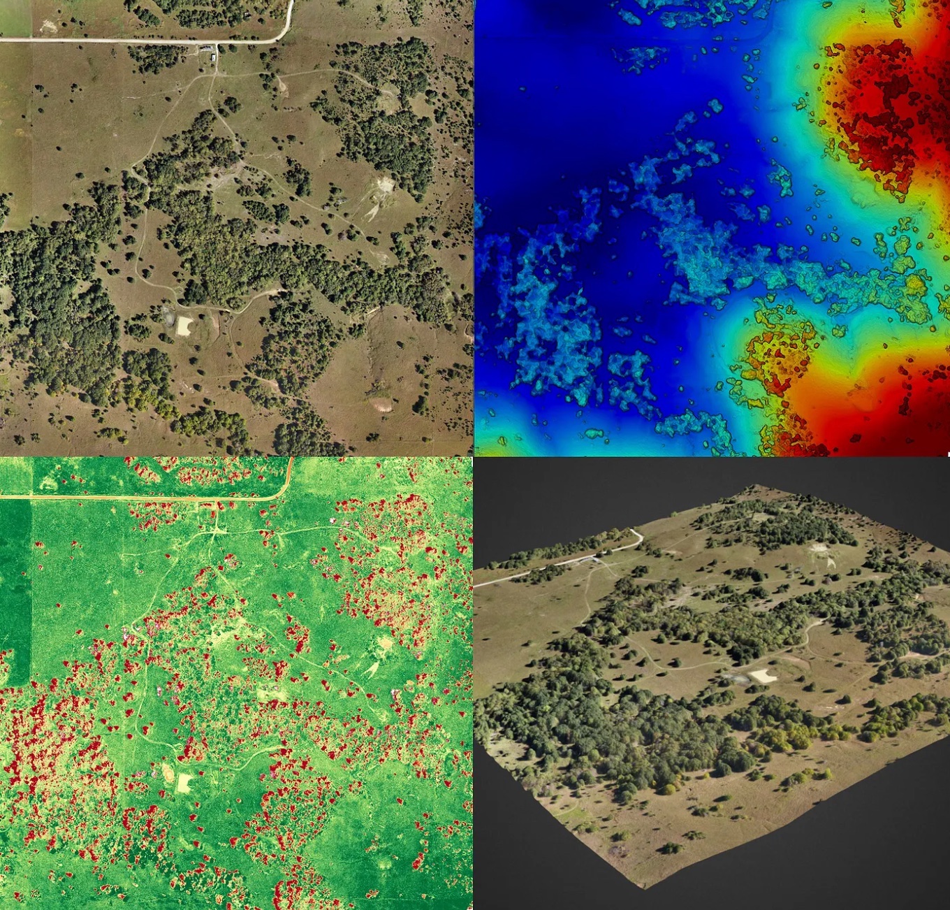
Four-Panel Site Analysis
Orthomosaic • NDVI • Elevation • 3D Model
3D point cloud drone mapping
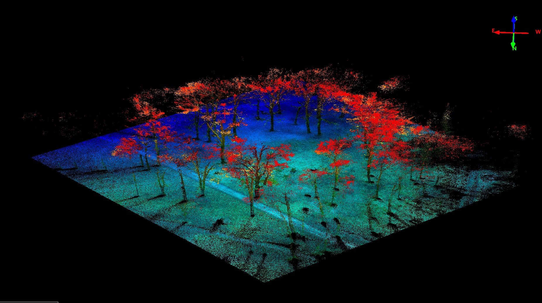
3D Point Cloud Model
Full terrain reconstruction
Construction BIM 3D site model
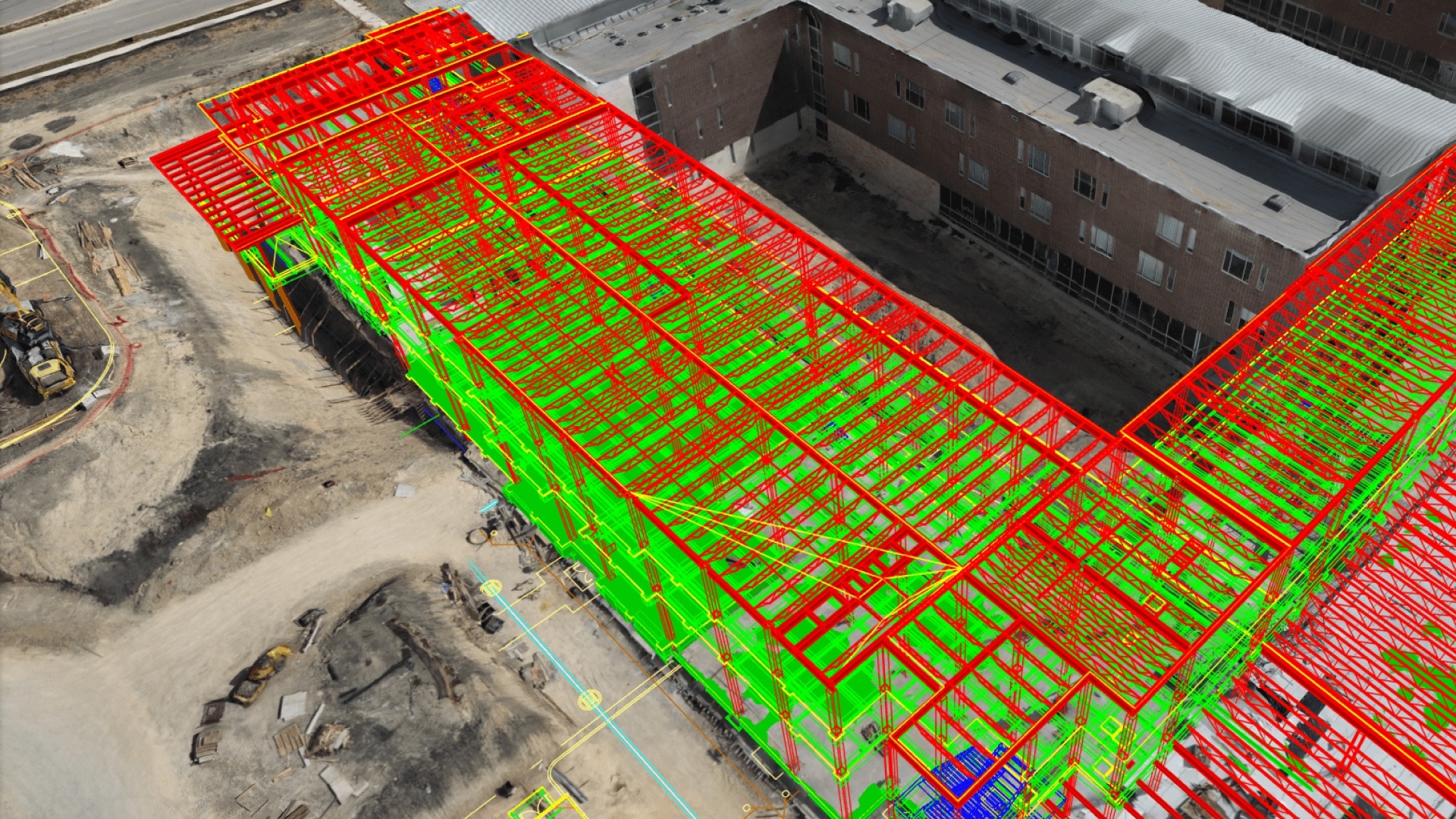
Construction / BIM Integration
Progress docs • Site surveys
Ready to add intelligence?

Available for any project.

Add-on to any real estate or construction project. Contact us to discuss your property and what Intelligence can document.

Now Launching

We're just getting started.

Early clients get priority scheduling and direct access to Garret. Let's talk about your project.